Geolocate

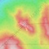
Rawson Lake topographic map

Click on the map to display elevation.

About this map

Name: Rawson Lake topographic map, elevation, terrain.

Location: Rawson Lake, Division No. 15, Alberta, Canada (50.58949 -115.15953 50.59501 -115.14805)

Average elevation: 2,162 m

Minimum elevation: 1,755 m

Maximum elevation: 3,145 m

Division No. 15 trails, hiking, mountain biking, running and outdoor activities

Other topographic maps

Click on a map to view its topography, its elevation and its terrain.
Ghost Lake

Canada > Alberta > Division No. 15

Average elevation: 1,241 m

Copper Mountain

Canada > Alberta > Division No. 15

Average elevation: 2,280 m

Eagle Hill

Canada > Alberta > Division No. 15

Average elevation: 1,576 m

Highwood Pass

Canada > Alberta > Division No. 15

Average elevation: 2,364 m

Dead Man's Flats

Canada > Alberta > Division No. 15

Average elevation: 1,424 m

Athabasca Glacier

Canada > Alberta > Division No. 15

Average elevation: 2,483 m

Upper Kananaskis Lake

Canada > Alberta > Division No. 15

Average elevation: 1,775 m

Mînî Thnî

Canada > Alberta > Division No. 15

Average elevation: 1,241 m

Toronto Peak

Canada > Alberta > Division No. 15

Average elevation: 2,423 m

Scarab Peak

Canada > Alberta > Division No. 15

Average elevation: 2,357 m

Lac des Arcs

Canada > Alberta > Division No. 15 > Lac des Arcs

Average elevation: 1,347 m

Gear up for your next adventure:

🥾Hiking Gaiters - Protect legs and shoes from mud, snow, and debris
👖Convertible Hiking Pants - Zip-off legs to adapt to changing weather conditions
☕Camping Coffee Maker - Brew fresh coffee anywhere on the topographic map
⛺Tent Footprint - Protect tent floor and increase durability
🥾Trekking Poles - Adjustable trekking poles to reduce knee stress and improve stability

As an Amazon Associate, this site earns from qualifying purchases at no extra cost to you.