Geolocate

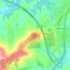
Farley topographic map

Click on the map to display elevation.

About this map

Name: Farley topographic map, elevation, terrain.

Location: Farley, Dubuque County, Iowa, 52046, United States (42.43336 -91.02869 42.45530 -90.99558)

Average elevation: 335 m

Minimum elevation: 308 m

Maximum elevation: 356 m

Other topographic maps

Click on a map to view its topography, its elevation and its terrain.
Centenial Cross

United States > Iowa > Dubuque County

Average elevation: 248 m

Gear up for your next adventure:

🧤Rechargeable Heated Gloves - Extreme warmth for Canadian winter expeditions
🧥Waterproof Pants - Keep dry during rainy hiking conditions
🥾Lightweight Hiking Shoes - Comfortable shoes for day hikes
🧳Compression Sacks - Maximize space in your backpack by shrinking gear
🧰Survival Kit - Essential gear for emergencies in the wilderness

As an Amazon Associate, this site earns from qualifying purchases at no extra cost to you.