Geolocate

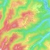
Bestovje topographic map

Click on the map to display elevation.

About this map

Name: Bestovje topographic map, elevation, terrain.

Location: Bestovje, Grad Sveta Nedelja, Zagreb County, 10437, Croatia (45.80004 15.80635 45.81576 15.83125)

Average elevation: 127 m

Minimum elevation: 114 m

Maximum elevation: 178 m

Other topographic maps

Click on a map to view its topography, its elevation and its terrain.
Beder

Croatia > Zagreb County > Grad Samobor

Average elevation: 414 m

Dubranec

Croatia > Zagreb County > City of Velika Gorica

Average elevation: 177 m

Donja Drenova

Croatia > Zagreb County

Average elevation: 215 m

Dubranec

Croatia > Zagreb County > City of Velika Gorica

Average elevation: 177 m

Prigorje Brdovečko

Croatia > Zagreb County

Average elevation: 161 m

Vernari

Croatia > Zagreb County > Gornji Stupnik

Average elevation: 129 m

Trstenik

Croatia > Zagreb County

Average elevation: 200 m

Gear up for your next adventure:

🎒Hiking Daypack - Lightweight and durable backpacks for day trips and excursions
🥫Freeze-Dried Meals - Lightweight, high-calorie nutrition for multi-day treks
🛁Quick-Dry Microfiber Towel - Space-saving towel that dries rapidly on the move
🔦LED Headlamp - Hands-free lighting for early morning starts or late finishes
🥾Hiking Shoes - Durable and comfortable shoes for trail hiking

As an Amazon Associate, this site earns from qualifying purchases at no extra cost to you.