Geolocate

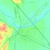
Calvin topographic map

Click on the map to display elevation.

About this map

Name: Calvin topographic map, elevation, terrain.

Location: Calvin, Bastrop County, Texas, United States (30.18744 -97.34727 30.22744 -97.30727)

Average elevation: 136 m

Minimum elevation: 109 m

Maximum elevation: 160 m

Other topographic maps

Click on a map to view its topography, its elevation and its terrain.
Cedar Creek

United States > Texas > Bastrop County

Average elevation: 125 m

Smithville

United States > Texas > Bastrop County

Average elevation: 100 m

Elgin

United States > Texas > Bastrop County

Average elevation: 167 m

Smithville

United States > Texas > Bastrop County

Average elevation: 100 m

Bastrop

United States > Texas > Bastrop County

Average elevation: 129 m

Line Creek

United States > Texas > Bastrop County

Average elevation: 130 m

Gear up for your next adventure:

🛰️Satellite Messenger - Emergency communication for areas with no cell service
🕶️Polarized Sunglasses - Reduces glare from snow and water at high elevations
💡LED Camping Lantern - Illuminate your campsite with long-lasting lanterns
🥾Trail Hiking Boots - Supportive boots for rough trails
🛶Kayak Accessories - Essential gear for safe and fun kayaking adventures

As an Amazon Associate, this site earns from qualifying purchases at no extra cost to you.