Geolocate

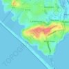
Chesil Beach topographic map

Click on the map to display elevation.

About this map

Name: Chesil Beach topographic map, elevation, terrain.

Location: Chesil Beach, Fleet, Wyke Regis, Chickerell, Dorset, England, United Kingdom (50.57646 -2.61259 50.65414 -2.47104)

Average elevation: 13 m

Minimum elevation: -3 m

Maximum elevation: 95 m

Other topographic maps

Click on a map to view its topography, its elevation and its terrain.
Mandeville

United Kingdom > England > Dorset > Chickerell > Wyke Regis

Average elevation: 11 m

Gear up for your next adventure:

⛺Camping Essentials - All-in-one gear for a comfortable camping trip
🏃Hydration Running Vest - Carry water and maps close to your body for speed
💡Solar Camping Lamp - Eco-friendly lighting for campsites
🥾Light Hiking Boots - Lightweight and comfortable boots for day hikes
👟Leg Gaiters - Keep debris, mud, and snow out of your boots

As an Amazon Associate, this site earns from qualifying purchases at no extra cost to you.