Geolocate

Bell Rock topographic map

Click on the map to display elevation.

About this map

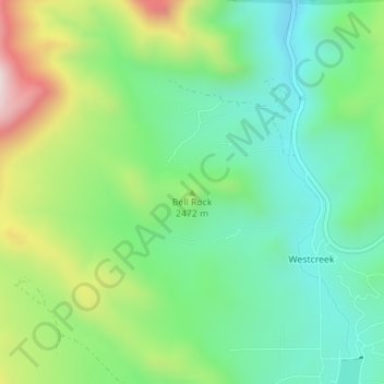
Name: Bell Rock topographic map, elevation, terrain.

Location: Bell Rock, Douglas County, Colorado, United States (39.15716 -105.17449 39.15726 -105.17439)

Average elevation: 2,414 m

Minimum elevation: 2,228 m

Maximum elevation: 2,794 m

Other topographic maps

Click on a map to view its topography, its elevation and its terrain.

Perry Park

United States > Colorado > Douglas County

Average elevation: 2,077 m

The Pinery

United States > Colorado > Douglas County > Castle Rock

Average elevation: 1,897 m

Four Square Park

United States > Colorado > Douglas County

Average elevation: 1,823 m

Russelville Gulch

United States > Colorado > Douglas County

Average elevation: 1,891 m

Larkspur

United States > Colorado > Douglas County

Average elevation: 2,102 m

Gear up for your next adventure:

🔭Compact Binoculars - Lightweight optics for scouting trails and wildlife
❄️Traction Ice Cleats - Slip-on spikes for icy trails and winter hiking
🦶Hiking Shoe Insoles - Added support for high arches and long days on feet
🚲Heavy Duty Bike Lock - Secure your bike at the trailhead or during stops
🧰Multitool Knife - Compact and versatile tool for outdoor use

As an Amazon Associate, this site earns from qualifying purchases at no extra cost to you.