Geolocate

Castle Pines topographic map

Click on the map to display elevation.

About this map

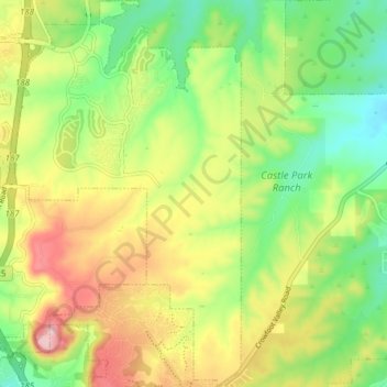
Name: Castle Pines topographic map, elevation, terrain.

Location: Castle Pines, Douglas County, Colorado, United States (39.41912 -104.87501 39.47823 -104.83021)

Average elevation: 1,936 m

Minimum elevation: 1,851 m

Maximum elevation: 2,048 m

Gear up for your next adventure:

🧥Fleece Jacket - Warm and lightweight jacket for layering
🧭GPS Outdoor Watch - Smart watch for navigation and fitness tracking in nature
🧥Waterproof Pants - Keep dry during rainy hiking conditions
🛰️Satellite Messenger - Emergency communication for areas with no cell service
🛏️Sleeping Bag - Warm and compact sleeping bags for outdoor camping

As an Amazon Associate, this site earns from qualifying purchases at no extra cost to you.