Geolocate

Treetops topographic map

Click on the map to display elevation.

About this map
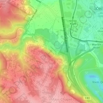
Name: Treetops topographic map, elevation, terrain.

Location: Treetops, Baltimore County, Maryland, United States (39.47013 -76.67287 39.47632 -76.66550)

Average elevation: 131 m

Minimum elevation: 54 m

Maximum elevation: 196 m

Other topographic maps

Click on a map to view its topography, its elevation and its terrain.

Parkville

United States > Maryland > Baltimore County

Average elevation: 91 m

Upperco

United States > Maryland > Baltimore County

Average elevation: 218 m

Gear up for your next adventure:

🛁Quick-Dry Microfiber Towel - Space-saving towel that dries rapidly on the move
🥾Hiking Shoes - Durable and comfortable shoes for trail hiking
🔦LED Headtorch - Bright and durable light for night activities
🧊Insulated Water Bottle - Keeps drinks cold in summer and prevents freezing in winter
🧢Outdoor Visor - Breathable visor for sunny hikes

As an Amazon Associate, this site earns from qualifying purchases at no extra cost to you.