Geolocate

Muirfield topographic map

Click on the map to display elevation.

About this map

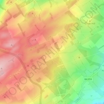
Name: Muirfield topographic map, elevation, terrain.

Location: Muirfield, Scottish Borders, Scotland, TD9 8QA, United Kingdom (55.45391 -2.79192 55.49391 -2.75192)

Average elevation: 227 m

Minimum elevation: 123 m

Maximum elevation: 312 m

Other topographic maps

Click on a map to view its topography, its elevation and its terrain.

Galashiels

United Kingdom > Scotland > Scottish Borders

Average elevation: 221 m

Gear up for your next adventure:

🌬️Windproof Camp Stove - Efficient cooking even on exposed mountain peaks
🧊Insulated Water Bottle - Keeps drinks cold in summer and prevents freezing in winter
💧Reusable Water Bottle - Durable water bottles for hydration on trails
🔦LED Headtorch - Bright and durable light for night activities
🥾Durable Hiking Shoes - Long-lasting shoes for frequent hiking

As an Amazon Associate, this site earns from qualifying purchases at no extra cost to you.