Geolocate

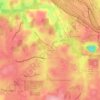
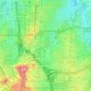
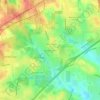
Alpharetta topographic map

Click on the map to display elevation.

About this map

Name: Alpharetta topographic map, elevation, terrain.

Location: Alpharetta, Fulton County, Georgia, United States (34.02815 -84.35944 34.11735 -84.20122)

Average elevation: 324 m

Minimum elevation: 261 m

Maximum elevation: 372 m

Other topographic maps

Click on a map to view its topography, its elevation and its terrain.
Hills Park

United States > Georgia > Fulton County > Atlanta

Average elevation: 269 m

Simsville

United States > Georgia > Fulton County > Atlanta

Average elevation: 275 m

Blair Village

United States > Georgia > Fulton County > Atlanta

Average elevation: 275 m

Shannon Chase

United States > Georgia > Fulton County > Fairburn

Average elevation: 301 m

Piedmont Park

United States > Georgia > Fulton County > Atlanta

Average elevation: 283 m

Grant Park

United States > Georgia > Fulton County > Atlanta

Average elevation: 298 m

Hardy Ivy Park

United States > Georgia > Fulton County > Atlanta

Average elevation: 310 m

Atlanta

United States > Georgia > Fulton County

Atlanta occupies a high, rolling part of the Georgia Piedmont, a physiographic region described as a landscape of low hills and narrow valleys between the Blue Ridge Mountains and the Upper Coastal Plain. Around downtown and Fulton County, the terrain is gently dissected rather than flat, with broad urban…

Average elevation: 285 m

Tomatoes

United States > Georgia > Fulton County > Atlanta

Average elevation: 269 m

Shannon Chase

United States > Georgia > Fulton County > Fairburn

Average elevation: 301 m

Piedmont Park

United States > Georgia > Fulton County > Atlanta

Average elevation: 283 m

South Fulton

United States > Georgia > Fulton County

Average elevation: 272 m

Alpharetta

United States > Georgia > Fulton County > Alpharetta

Average elevation: 325 m

Central Park

United States > Georgia > Fulton County > Atlanta

Average elevation: 301 m

Shake Rag

United States > Georgia > Fulton County > Johns Creek

Average elevation: 300 m

Shandra Estates

United States > Georgia > Fulton County

Average elevation: 289 m

Boulder Park

United States > Georgia > Fulton County > Atlanta

Average elevation: 257 m

Gear up for your next adventure:

🥾Trekking Poles - Adjustable trekking poles to reduce knee stress and improve stability
🔦LED Flashlight - Powerful and long-lasting flashlight for camping and emergencies
🧢Outdoor Cap - Protective cap for sun and rain during hikes
⛺Camping Tent - Weather-resistant tents suitable for 2 to 6 people
🧦Outdoor Socks - Durable socks designed for hiking and outdoor sports

As an Amazon Associate, this site earns from qualifying purchases at no extra cost to you.