Geolocate

Chapmanville topographic map

Click on the map to display elevation.

About this map

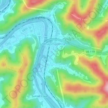
Name: Chapmanville topographic map, elevation, terrain.

Location: Chapmanville, Logan County, West Virginia, United States (37.95986 -82.03596 37.98248 -82.00524)

Average elevation: 276 m

Minimum elevation: 186 m

Maximum elevation: 454 m

Other topographic maps

Click on a map to view its topography, its elevation and its terrain.

Pardee

United States > West Virginia > Logan County

Average elevation: 581 m

Blair

United States > West Virginia > Logan County

Average elevation: 426 m

Sharples

United States > West Virginia > Logan County

Average elevation: 385 m

Mellville

United States > West Virginia > Logan County

Average elevation: 362 m

Sodom

United States > West Virginia > Logan County

Average elevation: 391 m

Gear up for your next adventure:

🥾Trail Hiking Boots - Supportive boots for rough trails
💧Collapsible Water Bottle - Space-saving water bottle for outdoor activities
🧢Hiking Hat - Sun-protective and breathable hats for long treks
🔭Compact Monocular - One-handed bird watching and trail spotting
🧢Sun Protection Cap - Breathable cap to protect from sun exposure

As an Amazon Associate, this site earns from qualifying purchases at no extra cost to you.