

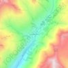
Lac Riondet topographic map
Click on the map to display elevation.
About this map

Name: Lac Riondet topographic map, elevation, terrain.
Average elevation: 2,455 m
Minimum elevation: 1,969 m
Maximum elevation: 2,934 m
Other topographic maps
Click on a map to view its topography, its elevation and its terrain.

Montrigon
France > Auvergne-Rhône-Alpes > Savoie > Bourg-Saint-Maurice > Arc 1600
Average elevation: 1,096 m


Versoye-les-Granges
France > Auvergne-Rhône-Alpes > Savoie > Bourg-Saint-Maurice
Average elevation: 1,669 m

La Millerette
France > Auvergne-Rhône-Alpes > Savoie > Bourg-Saint-Maurice > Arc 1600
Average elevation: 1,184 m


L'Ilaz
France > Auvergne-Rhône-Alpes > Savoie > Bourg-Saint-Maurice > L'Ilaz
Average elevation: 1,140 m

Arc 1950
France > Auvergne-Rhône-Alpes > Savoie > Bourg-Saint-Maurice
Le village d'Arc 1950 se trouve en Savoie à proximité du Parc National de la Vanoise, en vue du massif du Mont Blanc. Il se situe à 2 000 m d’altitude en contrebas de la station d'Arc 2000. Arc 1950 est situé au carrefour des autres villages de la station des Arcs mais également connecté avec la…
Average elevation: 2,246 m
La Ville des Glaciers
France > Auvergne-Rhône-Alpes > Savoie > Bourg-Saint-Maurice
Average elevation: 2,180 m


Les Échines Dessous
France > Auvergne-Rhône-Alpes > Savoie > Bourg-Saint-Maurice
Average elevation: 1,276 m


Chalets de Raja
France > Auvergne-Rhône-Alpes > Savoie > Bourg-Saint-Maurice
Average elevation: 2,019 m

Pointe de la Terrasse
France > Auvergne-Rhône-Alpes > Savoie > Bourg-Saint-Maurice
Average elevation: 2,271 m

Courbaton
France > Auvergne-Rhône-Alpes > Savoie > Bourg-Saint-Maurice > Arc 1600
Average elevation: 1,345 m

Bonneval les Bains
France > Auvergne-Rhône-Alpes > Savoie > Bourg-Saint-Maurice
Average elevation: 1,588 m

La Ville
France > Auvergne-Rhône-Alpes > Savoie > Bourg-Saint-Maurice > Arc 1600
Average elevation: 1,116 m

Les Lanches
France > Auvergne-Rhône-Alpes > Savoie > Bourg-Saint-Maurice > Arc 1600 > Les Lanches
Average elevation: 1,517 m


Les Charmettes
France > Auvergne-Rhône-Alpes > Savoie > Bourg-Saint-Maurice > Arc 1600
Average elevation: 1,489 m


Le Grand Gondon
France > Auvergne-Rhône-Alpes > Savoie > Bourg-Saint-Maurice
Average elevation: 1,086 m


Les Échines Dessus
France > Auvergne-Rhône-Alpes > Savoie > Bourg-Saint-Maurice
Average elevation: 1,334 m

Versoye-les-Granges
France > Auvergne-Rhône-Alpes > Savoie > Bourg-Saint-Maurice
Average elevation: 1,669 m