Curepipe topographic map
Click on the map to display elevation.
Curepipe
Curepipe (Mauritian Creole pronunciation: [kiːəpip]), also known as La Ville-Lumière (The City of Light), is a town in Mauritius, located mainly in the Plaines Wilhems District. Its eastern part lies in the Moka District. Known for its colonial architecture, the town is administered by the Municipal Council of Curepipe. Curepipe lies at a higher elevation, often referred to as the "Central Plateau". According to the census made by Statistics Mauritius in 2018, the population of the town was at 78,618.
About this map
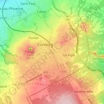
Name: Curepipe topographic map, elevation, terrain.
Location: Curepipe, Plaines Wilhems, Mauritius (-20.34651 57.48753 -20.29330 57.54984)
Average elevation: 538 m
Minimum elevation: 416 m
Maximum elevation: 653 m
Other topographic maps
Click on a map to view its topography, its elevation and its terrain.