Geolocate

Kula topographic map

Click on the map to display elevation.

About this map

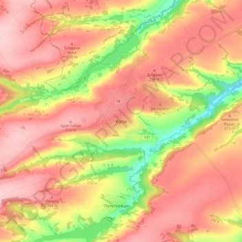
Name: Kula topographic map, elevation, terrain.

Location: Kula, Vidin, 3800, Bulgaria (43.84741 22.48039 43.92741 22.56039)

Average elevation: 259 m

Minimum elevation: 144 m

Maximum elevation: 329 m

Other topographic maps

Click on a map to view its topography, its elevation and its terrain.

Makresh

Bulgaria > Vidin

Average elevation: 371 m

Gear up for your next adventure:

🦌Outdoor Trail Camera - Monitor wildlife activity near your favorite spots
Lightweight Camping Tent - Portable shelter optimized for Canadian backcountry camping
🧴Outdoor Sunscreen - High SPF protection for high-altitude UV exposure
🛁Quick-Dry Microfiber Towel - Space-saving towel that dries rapidly on the move
💡Compact LED Flashlight - Powerful and portable flashlight for outdoor use

As an Amazon Associate, this site earns from qualifying purchases at no extra cost to you.