
Thank you for supporting this site ❤️
Make a donation
Make a donation
Gear up for your next adventure:
As an Amazon Associate, this site earns from qualifying purchases at no extra cost to you.
Potosi topographic map
Click on the map to display elevation.
Thank you for supporting this site ❤️
Make a donation
Make a donation
Gear up for your next adventure:
As an Amazon Associate, this site earns from qualifying purchases at no extra cost to you.
About this map
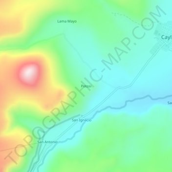
Name: Potosi topographic map, elevation, terrain.
Location: Potosi, Caylloma, Province of Caylloma, Arequipa, Peru (-15.22002 -71.81386 -15.18002 -71.77386)
Average elevation: 4,438 m
Minimum elevation: 4,284 m
Maximum elevation: 4,801 m
Thank you for supporting this site ❤️
Make a donation
Make a donation
Gear up for your next adventure:
As an Amazon Associate, this site earns from qualifying purchases at no extra cost to you.