Geolocate

Northstar topographic map

Click on the map to display elevation.

About this map

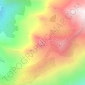
Name: Northstar topographic map, elevation, terrain.

Location: Northstar, Anchorage, Alaska, United States (60.99996 -148.97801 61.00006 -148.97791)

Average elevation: 996 m

Minimum elevation: 325 m

Maximum elevation: 1,586 m

Other topographic maps

Click on a map to view its topography, its elevation and its terrain.

Chugiak

United States > Alaska > Anchorage

Average elevation: 295 m

Laurel Acres

United States > Alaska > Anchorage

Average elevation: 25 m

Windemere

United States > Alaska > Anchorage

Average elevation: 33 m

Meadow View

United States > Alaska > Anchorage

Average elevation: 50 m

Hidden Cove

United States > Alaska > Anchorage

Average elevation: 19 m

Eagleridge

United States > Alaska > Anchorage

Average elevation: 134 m

Redoubt

United States > Alaska > Anchorage

Average elevation: 49 m

The Tablelands

United States > Alaska > Anchorage

Average elevation: 72 m

Windemere

United States > Alaska > Anchorage

Average elevation: 33 m

Gear up for your next adventure:

💧Collapsible Water Bottle - Space-saving water bottle for outdoor activities
🧦Outdoor Socks - Durable socks designed for hiking and outdoor sports
🛌Down Sleeping Bag - Superior warmth-to-weight ratio for cold nights
🛶Waterproof Dry Bags - Keep electronics and clothes dry during river crossings
🔋Lithium AA Batteries - Long-lasting power that performs in extreme cold

As an Amazon Associate, this site earns from qualifying purchases at no extra cost to you.