Geolocate

Aberdesach topographic map

Click on the map to display elevation.

About this map

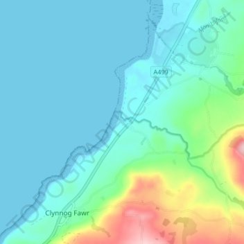
Name: Aberdesach topographic map, elevation, terrain.

Location: Aberdesach, Clynnog, Gwynedd, Wales, LL54 5EW, United Kingdom (53.01637 -4.37011 53.05637 -4.33011)

Average elevation: 36 m

Minimum elevation: 0 m

Maximum elevation: 193 m

Gear up for your next adventure:

🔭Compact Binoculars - Lightweight optics for scouting trails and wildlife
🧭Orienteering Kit - Tools for map reading and navigation in the wild
🌡️Emergency Mylar Blankets - Compact thermal protection for unexpected nights outdoors
👟Sport Hiking Sandals - Breathable footwear for water crossings and camp rest
🧤Insulated Winter Gloves - Heavy-duty protection for sub-zero Canadian adventures

As an Amazon Associate, this site earns from qualifying purchases at no extra cost to you.