
Greenville topographic map
Click on the map to display elevation.
About this map
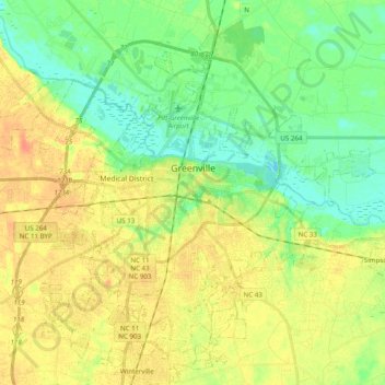
Name: Greenville topographic map, elevation, terrain.
Location: Greenville, Pitt County, North Carolina, United States (35.52978 -77.47527 35.67605 -77.27931)
Average elevation: 16 m
Minimum elevation: -3 m
Maximum elevation: 33 m
Other topographic maps
Click on a map to view its topography, its elevation and its terrain.
Hartington and Williams
United States > North Carolina > Pitt County > Greenville
Average elevation: 13 m
Hartington and Williams
United States > North Carolina > Pitt County > Greenville > Hartington and Williams
Average elevation: 13 m