Geolocate

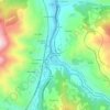
Zurea topographic map

Click on the map to display elevation.

About this map

Name: Zurea topographic map, elevation, terrain.

Location: Zurea, Lena, Asturias, Spain (43.07478 -5.88830 43.11493 -5.83365)

Average elevation: 811 m

Minimum elevation: 385 m

Maximum elevation: 1,477 m

Other topographic maps

Click on a map to view its topography, its elevation and its terrain.

El Corraón

Spain > Asturias > Lena

Average elevation: 505 m

Piedracea

Spain > Asturias > Lena

Average elevation: 598 m

Corneyana

Spain > Asturias > Lena

Average elevation: 582 m

Gear up for your next adventure:

🧥Waterproof Jacket - Lightweight rain jackets for hiking and outdoor activities
🧴First Aid Kit - Essential first aid supplies for outdoor emergencies
🔪Outdoor Multitool - Versatile tool for repairs and food prep in the wild
🥾Lightweight Hiking Boots - Boots for comfort and mobility on long hikes
🛶Kayak Accessories - Essential gear for safe and fun kayaking adventures

As an Amazon Associate, this site earns from qualifying purchases at no extra cost to you.