Geolocate

Kiamika topographic map

Click on the map to display elevation.

About this map

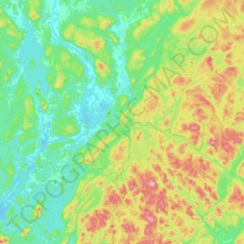
Name: Kiamika topographic map, elevation, terrain.

Location: Kiamika, Antoine-Labelle, Laurentides, Quebec, Canada (46.23031 -75.50341 46.52527 -75.21316)

Average elevation: 305 m

Minimum elevation: 196 m

Maximum elevation: 562 m

Antoine-Labelle trails, hiking, mountain biking, running and outdoor activities

Other topographic maps

Click on a map to view its topography, its elevation and its terrain.

Lac Prévost

Canada > Quebec > Antoine-Labelle > Lac-Ernest

Average elevation: 369 m

Val-Limoges

Canada > Quebec > Antoine-Labelle > Mont-Laurier

Average elevation: 289 m

Lac-Bazinet

Canada > Quebec > Antoine-Labelle

Average elevation: 483 m

Lac La Force

Canada > Quebec > Antoine-Labelle > Lac-Douaire

Average elevation: 506 m

Île Papineau

Canada > Quebec > Antoine-Labelle > Mont-Laurier

Average elevation: 282 m

Ruisseau Lanthier

Canada > Quebec > Antoine-Labelle > L'Ascension

Average elevation: 377 m

Lac Palma

Canada > Quebec > Antoine-Labelle > Lac-Bazinet

Average elevation: 571 m

Baie Fine

Canada > Quebec > Antoine-Labelle > Lac-Ernest

Average elevation: 279 m

Gear up for your next adventure:

🥾Trail Running Boots - Durable shoes designed for trail running
Backpacking Tent - Lightweight tent for long-distance hiking trips
🦟Insect Repellent - Keep mosquitoes and black flies away in wooded areas
🎒Backpack Rain Cover - External shield to keep your entire pack dry
🧥Thermal Fleece Jacket - Versatile insulation for changing mountain temperatures

As an Amazon Associate, this site earns from qualifying purchases at no extra cost to you.