Geolocate

Flintstone topographic map

Click on the map to display elevation.

About this map

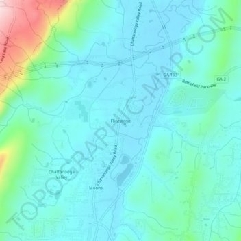
Name: Flintstone topographic map, elevation, terrain.

Location: Flintstone, Walker County, Georgia, 30725, United States (34.92174 -85.36357 34.96174 -85.32357)

Average elevation: 258 m

Minimum elevation: 200 m

Maximum elevation: 529 m

Other topographic maps

Click on a map to view its topography, its elevation and its terrain.

Lookout Mountain

United States > Georgia > Walker County

Average elevation: 406 m

Rock Spring

United States > Georgia > Walker County

Average elevation: 263 m

Fairview

United States > Georgia > Walker County

Average elevation: 263 m

Missionary Ridge

United States > Georgia > Walker County

Average elevation: 337 m

Gear up for your next adventure:

🧴Bear Spray Holster - Quick-access carry for essential Canadian wilderness safety
🪑Insulated Seat Pad - Protect your seat from cold rocks and wet logs
🔨Vehicle Emergency Tool - Safety tool for remote road trips to trailheads
🥾Hiking Leggings - Comfortable leggings for outdoor activities
🥾Light Trekking Boots - Supportive boots for multi-day treks

As an Amazon Associate, this site earns from qualifying purchases at no extra cost to you.