Geolocate

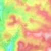
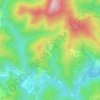
Rousses topographic map

Click on the map to display elevation.

About this map

Name: Rousses topographic map, elevation, terrain.

Location: Rousses, Florac, Lozère, Occitania, Metropolitan France, 48400, France (44.16142 3.53210 44.22716 3.60716)

Average elevation: 962 m

Minimum elevation: 564 m

Maximum elevation: 1,338 m

Other topographic maps

Click on a map to view its topography, its elevation and its terrain.
Sauveplane

France > Occitania > Lozère

Average elevation: 463 m

Les Vanels

France > Occitania > Lozère > Vebron

Average elevation: 813 m

Le Coustat

France > Occitania > Lozère > Nasbinals

Average elevation: 1,202 m

Lespartis

France > Occitania > Lozère > Peyre en Aubrac > Aumont-Aubrac

Average elevation: 1,047 m

Gear up for your next adventure:

🧥Softshell Jacket - Windproof and breathable jacket for hiking
🥾Mountain Trail Shoes - High-traction shoes for mountain trails
🚲MTB Frame Bag - Carry tools and maps directly on your bicycle frame
🧦Hiking Liner Socks - Thin base layer to prevent friction and blisters
🧦Thermal Socks - Warm socks for winter hiking or camping

As an Amazon Associate, this site earns from qualifying purchases at no extra cost to you.