Geolocate

Urraúl Alto topographic map

Click on the map to display elevation.

About this map
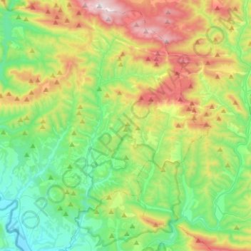
Name: Urraúl Alto topographic map, elevation, terrain.

Location: Urraúl Alto, Prepirineo, Navarra, 31448, España (42.69109 -1.31129 42.87530 -1.13131)

Average elevation: 773 m

Minimum elevation: 432 m

Maximum elevation: 1,467 m

Other topographic maps

Click on a map to view its topography, its elevation and its terrain.

La Salera

España > Navarra > Prepirineo > Urraúl Alto > Ongotz

Average elevation: 697 m

Olabe

España > Navarra > Prepirineo > Urraúl Alto

Average elevation: 751 m

Gear up for your next adventure:

🧤Rechargeable Heated Gloves - Extreme warmth for Canadian winter expeditions
🧥Waterproof Pants - Keep dry during rainy hiking conditions
🥾Approach Boots - Comfortable boots for hiking and climbing approaches
🧶550 Survival Paracord - Versatile utility cord for emergency repairs and rigging
🔪Outdoor Multitool - Versatile tool for repairs and food prep in the wild

As an Amazon Associate, this site earns from qualifying purchases at no extra cost to you.