Geolocate

Loa topographic map

Click on the map to display elevation.

About this map

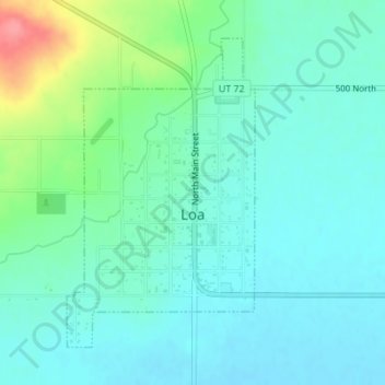
Name: Loa topographic map, elevation, terrain.

Location: Loa, Wayne County, Utah, 84747, United States (38.39343 -111.65426 38.41513 -111.63738)

Average elevation: 2,158 m

Minimum elevation: 2,140 m

Maximum elevation: 2,220 m

Other topographic maps

Click on a map to view its topography, its elevation and its terrain.

The Notch

United States > Utah > Wayne County

Average elevation: 1,409 m

Teasdale

United States > Utah > Wayne County

Average elevation: 2,200 m

Factory Butte

United States > Utah > Wayne County

Average elevation: 1,517 m

Skyline Rim Overlook

United States > Utah > Wayne County

Average elevation: 1,439 m

Fruita

United States > Utah > Wayne County

Average elevation: 1,803 m

Gear up for your next adventure:

Camping Tent - Weather-resistant tents suitable for 2 to 6 people
🥾Trail Hiking Socks - Comfortable socks to prevent blisters and fatigue
🧦Merino Wool Socks - Moisture-wicking comfort for long-distance hiking
🛌Down Sleeping Bag - Superior warmth-to-weight ratio for cold nights
🧭Orienteering Kit - Tools for map reading and navigation in the wild

As an Amazon Associate, this site earns from qualifying purchases at no extra cost to you.