Geolocate

Obermieming topographic map

Click on the map to display elevation.

About this map

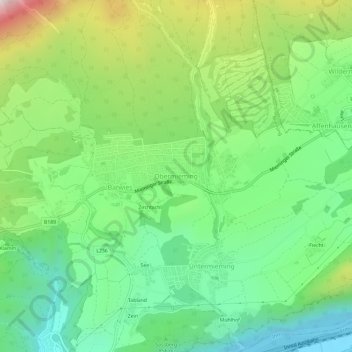
Name: Obermieming topographic map, elevation, terrain.

Location: Obermieming, Mieming, Bezirk Imst, Tyrol, 6414, Austria (47.28642 10.95722 47.32642 10.99722)

Average elevation: 884 m

Minimum elevation: 629 m

Maximum elevation: 1,372 m

Gear up for your next adventure:

🚲MTB Frame Bag - Carry tools and maps directly on your bicycle frame
🎒Hiking Daypack - Lightweight and durable backpacks for day trips and excursions
🗺️Topographic Maps - Detailed maps to explore trails, mountains, and wilderness areas
🕶️Polarized Sunglasses - Reduces glare from snow and water at high elevations
🚲Heavy Duty Bike Lock - Secure your bike at the trailhead or during stops

As an Amazon Associate, this site earns from qualifying purchases at no extra cost to you.