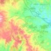
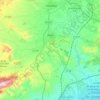
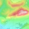
L'Eliana topographic map
Click on the map to display elevation.
About this map

Name: L'Eliana topographic map, elevation, terrain.
Average elevation: 97 m
Minimum elevation: 75 m
Maximum elevation: 128 m
Other topographic maps
Click on a map to view its topography, its elevation and its terrain.
Valencia
Spain > Valencian Community > Comarca de València
The maximum of precipitation occurs in the Autumn, coinciding with the time of the year when cold drop (gota fría) episodes of heavy rainfall—associated to cut-off low pressure systems at high altitude— are common along the Western mediterranean coast. The year-on-year variability in precipitation may be,…
Average elevation: 37 m
Valencia
Spain > Valencian Community > Comarca de València
The maximum of precipitation occurs in the Autumn, coinciding with the time of the year when cold drop (gota fría) episodes of heavy rainfall—associated to cut-off low pressure systems at high altitude— are common along the Western mediterranean coast. The year-on-year variability in precipitation may be,…
Average elevation: 37 m

Guardamar del Segura
Spain > Valencian Community > el Baix Segura / La Vega Baja
Average elevation: 9 m



Mirador de l'Ermita de la Mare de Déu dels Àngels
Spain > Valencian Community > el Baix Maestrat > Sant Mateu
Average elevation: 351 m


Mirador del Mestrat
Spain > Valencian Community > el Baix Maestrat > la Salzadella
Average elevation: 482 m





Nàquera / Náquera
Located at the foothills of the Sierra Calderona, it is known as the "door to the Calderona". The town is placed on the side of a mound of 215 m of altitude, split by the Naquera Creek; it is accessed through agricultural areas and residential suburbs, composed of little villas or chalets, mainly inhabited on…
Average elevation: 176 m


Valencia
Spain > Valencian Community > Comarca de València
The maximum of precipitation occurs in the Autumn, coinciding with the time of the year when cold drop (gota fría) episodes of heavy rainfall—associated to cut-off low pressure systems at high altitude— are common along the Western mediterranean coast. The year-on-year variability in precipitation may be,…
Average elevation: 37 m


Cullera
The mountain of Cullera, known as Munt de l'Or or Muntanya de l'Or, is the last mountain in the Iberian System before the Mediterranean Sea. It has an altitude of 233 meters. The historical parts of the city are to the south, and the modern tourist district is to the east, looking to the sea.
Average elevation: 18 m
Cap de la Nau
Spain > Valencian Community > Xàbia / Jávea
Atop the headland, at an elevation of 120 metres (390 ft), stands the Cap de la Nau lighthouse, providing an important aid to navigation.
Average elevation: 32 m

Castalla
Castalla Castle sits on a hill overlooking the valley and the town is around, at the foot of the hill, 680 m above sea level. Castalla La Hoya, whose history is Castalla capital, is a broad valley in the form of T oriented to the southeast and sandwiched between various mountain formations. Castalla occupies…
Average elevation: 731 m
Valencia
Spain > Valencian Community > Comarca de València
Peak precipitation occurs in autumn, coinciding with the time of the year when cold drop (gota fría) episodes of heavy rainfall—associated with cut-off low pressure systems at high altitude— are common along the Western mediterranean coast. The year-on-year variability in precipitation may be, however,…
Average elevation: 37 m
San Miguel de Salinas
Spain > Valencian Community > el Baix Segura / La Vega Baja del Segura
Average elevation: 81 m

Morella
Morella has an Oceanic climate (Köppen: Cfb) highly influenced by its altitude around 1,000 metres (3,300 ft) and its well inland location, with warm summers and cool winters (cold for Spanish standards) with frequent frosts and snow. Temperatures as low as −10 °C (14 °F) and heavy snowfalls can happen…
Average elevation: 949 m
Valencia
Spain > Valencian Community > Comarca de València
The maximum of precipitation occurs in autumn, coinciding with the time of the year when cold drop (gota fría) episodes of heavy rainfall—associated to cut-off low pressure systems at high altitude— are common along the Western mediterranean coast. The year-on-year variability in precipitation may be,…
Average elevation: 37 m
Playa Flamenca I
Spain > Valencian Community > el Baix Segura / La Vega Baja del Segura > Orihuela > Urbanización La Zenia
Average elevation: 25 m
Urbanización Doña Pepa
Spain > Valencian Community > el Baix Segura / La Vega Baja del Segura > Rojales
Average elevation: 24 m