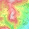
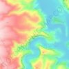
Castielfabib topographic map
Click on the map to display elevation.
Castielfabib
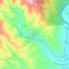
Known as "the small Albarracín", Castielfabib is located on a hill near the right bank of the river Ebrón. Located in the northwest corner of Rincon de Ademuz, it is mountainous with elevation ranging between 800 and 1,550 metres (2,600 and 5,100 ft). The most important points of elevation are: Mill Creek (1,338 m), Peña de Águila (1,112 m), Peral (1481 m), Cabezo (1,442 m), Macarron (1,222 m), Umbria La Muela (1,068 m) and Cross of the Three Kingdoms (1,552 m), so named because its summit joined the old kingdoms of Aragon, Castile and Valencia. The river Turia flows from the north, serving as the border with Teruel. It flows on the east of Riodeva, bordering Torre Baja. Ebrón River crosses the territory from northwest to southeast, flowing into Turia, the boulevard of Palomarejos runs north and comes to the precipice of the Canaleja. The climate is continental, with prevailing winds from the north and east, the latter bringing rains in April.
About this map

Name: Castielfabib topographic map, elevation, terrain.
Average elevation: 1,047 m
Minimum elevation: 708 m
Maximum elevation: 1,492 m
Other topographic maps
Click on a map to view its topography, its elevation and its terrain.


Serra d'Aitana
Spain > Valencian Community > la Marina Baixa > Benifato
The most spectacular part of the trail is the Font de Partagás - Pas de la rabossa - Summit of Aitana with a distance of 2 km. It starts at 1040 meters elevation, with almost 500 meters of uneven terrain. The path is well signposted with trail markings and distance signs.
Average elevation: 836 m

La Marina
Spain > Valencian Community > el Baix Segura / La Vega Baja > Guardamar del Segura
Average elevation: 7 m

Mirador de l'Ermita de la Mare de Déu dels Àngels
Spain > Valencian Community > el Baix Maestrat > Sant Mateu
Average elevation: 351 m


Mirador del Mestrat
Spain > Valencian Community > el Baix Maestrat > la Salzadella
Average elevation: 482 m



Cabo Roig
Spain > Valencian Community > el Baix Segura / La Vega Baja del Segura > Orihuela
Average elevation: 9 m

Cap de la Nau
Spain > Valencian Community > Xàbia / Jávea
Atop the headland, at an elevation of 120 metres (390 ft), stands the Cap de la Nau lighthouse, providing an important aid to navigation.
Average elevation: 32 m
Torre de la Horadada
Spain > Valencian Community > el Baix Segura / La Vega Baja del Segura > Pilar de la Horadada
Average elevation: 5 m
Urbanización Doña Pepa
Spain > Valencian Community > el Baix Segura / La Vega Baja del Segura > Rojales
Average elevation: 24 m
Playa Flamenca I
Spain > Valencian Community > el Baix Segura / La Vega Baja del Segura > Orihuela > Urbanización La Zenia
Average elevation: 25 m
la Garrotxa
Spain > Valencian Community > Castelló / Castellón > Cervera del Maestre
Average elevation: 273 m
La Mata
Spain > Valencian Community > el Baix Segura / La Vega Baja > Torrevieja
Average elevation: 5 m

Dehesa de Campoamor
Spain > Valencian Community > el Baix Segura / La Vega Baja del Segura > Orihuela
Average elevation: 28 m

Platja del Cabanyal - Les Arenes
Spain > Valencian Community > Comarca de València > Valencia
Average elevation: 2 m
Raiguero de Bonanza
Spain > Valencian Community > el Baix Segura / La Vega Baja > Orihuela
Average elevation: 139 m
La Mata
Spain > Valencian Community > el Baix Segura / La Vega Baja > Torrevieja
Average elevation: 5 m
Castell de Benissili
Spain > Valencian Community > la Vall de Gallinera > Benissili
Average elevation: 629 m


Balsa de riego goteo Pozo la Esperanza
Spain > Valencian Community > Nàquera / Náquera
Average elevation: 92 m
Castell de Benissili
Spain > Valencian Community > la Vall de Gallinera > Benissili
Average elevation: 629 m
Coma Breco
Spain > Valencian Community > el Poble Nou de Benitatxell / Benitachell
Average elevation: 147 m