Geolocate

Payhembury topographic map

Click on the map to display elevation.

About this map

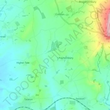
Name: Payhembury topographic map, elevation, terrain.

Location: Payhembury, East Devon, Devon, England, United Kingdom (50.78899 -3.34115 50.82971 -3.25573)

Average elevation: 100 m

Minimum elevation: 46 m

Maximum elevation: 274 m

Gear up for your next adventure:

🛏️Camping Sleeping Mat - Comfortable mats for sleeping outdoors
🥾Approach Shoes - Shoes designed for climbing approaches and rugged trails
🚲Handlebar Phone Mount - View topographic-map.com live while cycling
👟Sport Hiking Sandals - Breathable footwear for water crossings and camp rest
🥾Lightweight Hiking Shoes - Comfortable shoes for day hikes

As an Amazon Associate, this site earns from qualifying purchases at no extra cost to you.