
Thank you for supporting this site ❤️
Make a donation
Make a donation
Gear up for your next adventure:
As an Amazon Associate, this site earns from qualifying purchases at no extra cost to you.
Sohan topographic map
Click on the map to display elevation.
Thank you for supporting this site ❤️
Make a donation
Make a donation
Gear up for your next adventure:
As an Amazon Associate, this site earns from qualifying purchases at no extra cost to you.
About this map
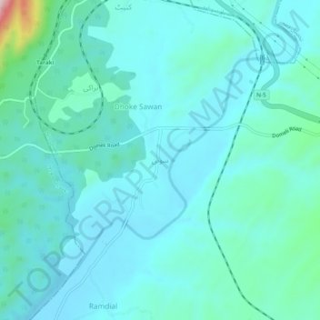
Name: Sohan topographic map, elevation, terrain.
Location: Sohan, Tehsil Dina, Jhelum District, Punjab, Pakistan (33.03589 73.42372 33.07589 73.46372)
Average elevation: 343 m
Minimum elevation: 297 m
Maximum elevation: 632 m
Thank you for supporting this site ❤️
Make a donation
Make a donation
Gear up for your next adventure:
As an Amazon Associate, this site earns from qualifying purchases at no extra cost to you.