Geolocate

Ribolla topographic map

Click on the map to display elevation.

About this map

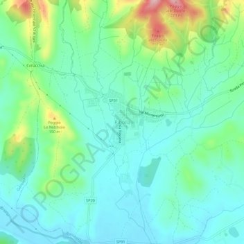
Name: Ribolla topographic map, elevation, terrain.

Location: Ribolla, Roccastrada, Grosseto, Tuscany, 58027, Italy (42.94870 11.01485 42.98870 11.05485)

Average elevation: 74 m

Minimum elevation: 29 m

Maximum elevation: 206 m

Other topographic maps

Click on a map to view its topography, its elevation and its terrain.

Sorano

Italy > Tuscany > Grosseto

Average elevation: 457 m

Monte Argentario

Italy > Tuscany > Grosseto

Average elevation: 89 m

Roccastrada

Italy > Tuscany > Grosseto

Average elevation: 245 m

Santa Fiora

Italy > Tuscany > Grosseto

Average elevation: 810 m

Massa Marittima

Italy > Tuscany > Grosseto > Massa Marittima

Average elevation: 276 m

Gear up for your next adventure:

🧤Insulated Winter Gloves - Heavy-duty protection for sub-zero Canadian adventures
Lightweight Backpacking Tent - Compact tent for efficient hiking trips
🥾Approach Boots - Comfortable boots for hiking and climbing approaches
🧥Waterproof Hiking Jacket - Protect yourself from rain and wind while hiking
🔦UV Flashlight - Detect minerals or specific insects in the dark

As an Amazon Associate, this site earns from qualifying purchases at no extra cost to you.