Geolocate

Massa Marittima topographic map

Click on the map to display elevation.

About this map

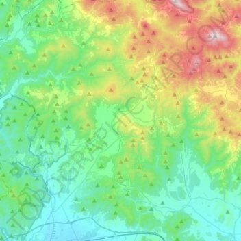
Name: Massa Marittima topographic map, elevation, terrain.

Location: Massa Marittima, Grosseto, Tuscany, 58024, Italy (42.95874 10.75366 43.14257 11.04847)

Average elevation: 276 m

Minimum elevation: 8 m

Maximum elevation: 1,047 m

Gear up for your next adventure:

🧭GPS Tracker - Track your location in remote areas safely
Camping Essentials - All-in-one gear for a comfortable camping trip
🧤Thermal Hiking Gloves - Grip-enhanced gloves for cold-weather altitude trekking
🎒Fully Waterproof Backpack - Total protection for photography gear and electronics
💡LED Camping Lantern - Illuminate your campsite with long-lasting lanterns

As an Amazon Associate, this site earns from qualifying purchases at no extra cost to you.