Geolocate

White Notley topographic map

Click on the map to display elevation.

About this map

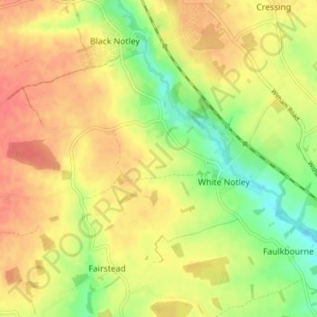
Name: White Notley topographic map, elevation, terrain.

Location: White Notley, Braintree, Essex, England, United Kingdom (51.82465 0.54128 51.84941 0.61092)

Average elevation: 55 m

Minimum elevation: 24 m

Maximum elevation: 78 m

Gear up for your next adventure:

🔭Compact Monocular - One-handed bird watching and trail spotting
💡Compact LED Flashlight - Powerful and portable flashlight for outdoor use
🥾Trail Hiking Socks - Comfortable socks to prevent blisters and fatigue
🌬️Windproof Camp Stove - Efficient cooking even on exposed mountain peaks
🧦Thermal Socks - Warm socks for winter hiking or camping

As an Amazon Associate, this site earns from qualifying purchases at no extra cost to you.