Geolocate

Sikeston topographic map

Click on the map to display elevation.

About this map

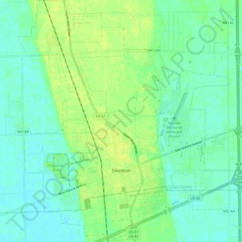
Name: Sikeston topographic map, elevation, terrain.

Location: Sikeston, Scott County, Missouri, 63801, United States (36.85014 -89.63596 36.93999 -89.52668)

Average elevation: 97 m

Minimum elevation: 90 m

Maximum elevation: 105 m

Other topographic maps

Click on a map to view its topography, its elevation and its terrain.

Kagel

United States > Missouri > Scott County

Average elevation: 113 m

Illmo

United States > Missouri > Scott County > Scott City

Average elevation: 123 m

Gear up for your next adventure:

Backpacking Tent - Lightweight tent for long-distance hiking trips
🥾Waterproof Trail Shoes - Shoes designed to handle wet terrain
🧭GPS Tracker - Track your location in remote areas safely
Tent Footprint - Protect tent floor and increase durability
🥤Collapsible Travel Cup - Saves space and weight in your mess kit

As an Amazon Associate, this site earns from qualifying purchases at no extra cost to you.