Geolocate

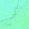
Kirton CP topographic map

Click on the map to display elevation.

About this map
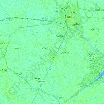
Name: Kirton CP topographic map, elevation, terrain.

Location: Kirton CP, Boston, Lincolnshire, Greater Lincolnshire, England, United Kingdom (52.89333 -0.14492 52.97639 0.06453)

Average elevation: 4 m

Minimum elevation: 0 m

Maximum elevation: 8 m

Other topographic maps

Click on a map to view its topography, its elevation and its terrain.
Benington

United Kingdom > England > Lincolnshire > Boston

Average elevation: 4 m

Boston

United Kingdom > England > Lincolnshire > Boston > Boston

Average elevation: 4 m

Sutterton

United Kingdom > England > Lincolnshire > Boston

Average elevation: 4 m

Fishtoft

United Kingdom > England > Lincolnshire > Boston

Average elevation: 4 m

Gear up for your next adventure:

🧦Hiking Liner Socks - Thin base layer to prevent friction and blisters
💧Hydration Bladder - Hands-free hydration solution for long treks
🥾Trail Hiking Boots - Supportive boots for rough trails
🧢Beanie Hat - Keep your head warm in cold weather
🪑Insulated Seat Pad - Protect your seat from cold rocks and wet logs

As an Amazon Associate, this site earns from qualifying purchases at no extra cost to you.