Geolocate

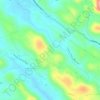
Chuttippara topographic map

Click on the map to display elevation.

About this map

Name: Chuttippara topographic map, elevation, terrain.

Location: Chuttippara, Kozhencherry, Pathanamthitta, Kerala, 689671, India (9.26474 76.79537 9.26484 76.79547)

Average elevation: 36 m

Minimum elevation: 15 m

Maximum elevation: 116 m

Other topographic maps

Click on a map to view its topography, its elevation and its terrain.
Arattupuzha

India > Kerala > Kozhencherry > Malakkara

Average elevation: 12 m

Prakkanam

India > Kerala > Kozhencherry > Prakkanam

Average elevation: 58 m

Gear up for your next adventure:

🧥Softshell Jacket - Windproof and breathable jacket for hiking
🧣Merino Neck Gaiter - Protects against wind, sun, and cold at high altitudes
🧥Insulated Jacket - Keep warm in cold outdoor conditions
💡Compact LED Flashlight - Powerful and portable flashlight for outdoor use
🔪Outdoor Multitool - Versatile tool for repairs and food prep in the wild

As an Amazon Associate, this site earns from qualifying purchases at no extra cost to you.