Geolocate

Highest Point topographic map

Click on the map to display elevation.

About this map

Name: Highest Point topographic map, elevation, terrain.

Location: Highest Point, Sowe Valley Footpath, Manor Farm Estate, Coventry, West Midlands, England, CV2 1HZ, United Kingdom (52.42380 -1.45729 52.42390 -1.45719)

Average elevation: 84 m

Minimum elevation: 69 m

Maximum elevation: 101 m

Other topographic maps

Click on a map to view its topography, its elevation and its terrain.
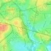
Charterhouse

United Kingdom > England > Coventry

Average elevation: 86 m

Prior Deram Park

United Kingdom > England > Coventry

Average elevation: 98 m

Charterhouse Field

United Kingdom > England > Coventry

Average elevation: 85 m

Keresley

United Kingdom > England > Coventry

Average elevation: 128 m

Longford Park

United Kingdom > England > Coventry

Average elevation: 94 m

Gear up for your next adventure:

🥾Mountain Trail Shoes - High-traction shoes for mountain trails
🧢Hiking Sun Hat - Wide-brimmed protection for exposed mountain ridges
💡LED Headlamp - Hands-free illumination for night hiking and camping
🎒Hiking Backpack - Lightweight and ergonomic backpacks for day hikes or multi-day treks
🔥Emergency Fire Starter - Reliable ignition source for all weather conditions

As an Amazon Associate, this site earns from qualifying purchases at no extra cost to you.