Geolocate

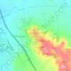
Knightcote topographic map

Click on the map to display elevation.

About this map

Name: Knightcote topographic map, elevation, terrain.

Location: Knightcote, Burton Dassett CP, Northend, Stratford-on-Avon, Warwickshire, England, CV47 2SF, United Kingdom (52.16739 -1.43741 52.20739 -1.39741)

Average elevation: 101 m

Minimum elevation: 87 m

Maximum elevation: 175 m

Other topographic maps

Click on a map to view its topography, its elevation and its terrain.
Gear up for your next adventure:

🧢Sun Protection Cap - Breathable cap to protect from sun exposure
🪑Insulated Seat Pad - Protect your seat from cold rocks and wet logs
🛶Waterproof Dry Bags - Keep electronics and clothes dry during river crossings
🧥Fleece Jacket - Warm and lightweight jacket for layering
👟Leg Gaiters - Keep debris, mud, and snow out of your boots

As an Amazon Associate, this site earns from qualifying purchases at no extra cost to you.