
Greentown topographic map
Click on the map to display elevation.
About this map
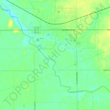
Name: Greentown topographic map, elevation, terrain.
Location: Greentown, Howard County, Indiana, United States (40.45077 -85.97860 40.48808 -85.94756)
Average elevation: 258 m
Minimum elevation: 248 m
Maximum elevation: 268 m
Other topographic maps
Click on a map to view its topography, its elevation and its terrain.