Geolocate

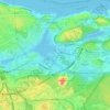
Gröndal topographic map

Click on the map to display elevation.

About this map

Name: Gröndal topographic map, elevation, terrain.

Location: Gröndal, Hägersten-Älvsjö stadsdelsområde, Stockholm, Stockholms kommun, Stockholm County, Sweden (59.31014 17.97029 59.32212 18.01819)

Average elevation: 18 m

Minimum elevation: -1 m

Maximum elevation: 59 m

Other topographic maps

Click on a map to view its topography, its elevation and its terrain.
Hammarby sjöstad

Sweden > Stockholm County > Stockholm

Average elevation: 25 m

Långholmen

Sweden > Stockholm County > Stockholm

Average elevation: 17 m

Kjolen

Sweden > Stockholm County > Stockholm

Average elevation: 39 m

Tiveden

Sweden > Stockholm County > Stockholm

Average elevation: 18 m

Ingarö

Sweden > Stockholm County > Stockholm

Average elevation: 37 m

Sylarna

Sweden > Stockholm County > Stockholm

Average elevation: 17 m

Hammarby sjöstad

Sweden > Stockholm County > Stockholm

Average elevation: 25 m

Ardennern

Sweden > Stockholm County > Stockholm

Average elevation: 14 m

Guten

Sweden > Stockholm County > Stockholm

Average elevation: 19 m

Gear up for your next adventure:

🛁Quick-Dry Microfiber Towel - Space-saving towel that dries rapidly on the move
🥾Mountain Hiking Shoes - Shoes with superior grip for mountainous terrain
🍽️Titanium Camping Spork - Ultralight and indestructible eating utensil
🧦Hiking Socks - Moisture-wicking and comfortable socks for long hikes
🧊Portable Cooler - Keep food and drinks cold during outdoor adventures

As an Amazon Associate, this site earns from qualifying purchases at no extra cost to you.