Geolocate

Millet topographic map

Click on the map to display elevation.

About this map

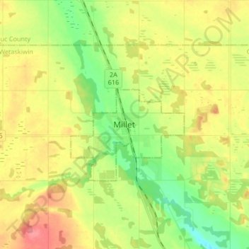
Name: Millet topographic map, elevation, terrain.

Location: Millet, Town of Millet, Alberta, T0C 1Z0, Canada (53.05410 -113.51193 53.13410 -113.43193)

Average elevation: 765 m

Minimum elevation: 732 m

Maximum elevation: 803 m

Town of Millet trails, hiking, mountain biking, running and outdoor activities

Gear up for your next adventure:

🧥Waterproof Hiking Jacket - Protect yourself from rain and wind while hiking
🥾Trail Hiking Socks - Comfortable socks to prevent blisters and fatigue
🌡️Emergency Mylar Blankets - Compact thermal protection for unexpected nights outdoors
🕯️Camping Lantern - Illuminates your entire campsite with high-efficiency LEDs
🚲MTB Frame Bag - Carry tools and maps directly on your bicycle frame

As an Amazon Associate, this site earns from qualifying purchases at no extra cost to you.