
Tinsley Green topographic map
Interactive map
Click on the map to display elevation.
About this map
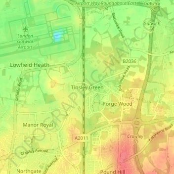
Name: Tinsley Green topographic map, elevation, terrain.
Average elevation: 67 m
Minimum elevation: 37 m
Maximum elevation: 91 m
Other topographic maps
Click on a map to view its topography, its elevation and its terrain.
Manor Royal
United Kingdom > England > West Sussex > Crawley
Manor Royal, Crawley, West Sussex, England, RH10 9SP, United Kingdom
Average elevation: 68 m
Forge Wood
United Kingdom > England > West Sussex > Crawley
Forge Wood, Crawley, West Sussex, England, RH10 3NH, United Kingdom
Average elevation: 70 m
Pound Hill
United Kingdom > England > West Sussex > Crawley
Pound Hill, Crawley, West Sussex, England, RH10 7TS, United Kingdom
Average elevation: 80 m
Gossops Green
United Kingdom > England > West Sussex > Crawley > Gossops Green
Gossops Green, Crawley, West Sussex, South East England, England, RH11 8EX, United Kingdom
Average elevation: 80 m