Geolocate

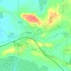
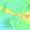
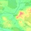
Shinrone topographic map

Click on the map to display elevation.

About this map

Name: Shinrone topographic map, elevation, terrain.

Location: Shinrone, Shinrone ED, The Municipal District of Birr, County Offaly, Leinster, Ireland (52.97378 -7.93625 52.99601 -7.90186)

Average elevation: 72 m

Minimum elevation: 51 m

Maximum elevation: 96 m

Other topographic maps

Click on a map to view its topography, its elevation and its terrain.

Cappincur

Ireland > County Offaly

Average elevation: 65 m

Charlestown

Ireland > County Offaly > Charlestown

Average elevation: 61 m

Rahan

Ireland > County Offaly

Average elevation: 53 m

Ballycommon

Ireland > County Offaly

Average elevation: 80 m

Rath

Ireland > County Offaly

Average elevation: 66 m

Daingean

Ireland > County Offaly

Average elevation: 82 m

Durrow

Ireland > County Offaly

Average elevation: 66 m

Mount Lucas

Ireland > County Offaly

Average elevation: 76 m

Croghan

Ireland > County Offaly

Average elevation: 100 m

Rathvilla

Ireland > County Offaly

Average elevation: 72 m

Banagher

Ireland > County Offaly > Banagher

Average elevation: 43 m

Coolderry

Ireland > County Offaly

Average elevation: 107 m

Harbour

Ireland > County Offaly

Average elevation: 62 m

Rahan

Ireland > County Offaly

Average elevation: 53 m

Gear up for your next adventure:

🥫Freeze-Dried Meals - Lightweight, high-calorie nutrition for multi-day treks
🥾Trekking Boots - Durable boots for long-distance trekking
🛁Quick-Dry Microfiber Towel - Space-saving towel that dries rapidly on the move
🥾Approach Boots - Comfortable boots for hiking and climbing approaches
🥾Mountaineering Boots - Supportive boots for climbing and high-altitude hiking

As an Amazon Associate, this site earns from qualifying purchases at no extra cost to you.