Geolocate

Low Ham topographic map

Click on the map to display elevation.

About this map

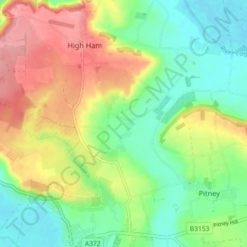
Name: Low Ham topographic map, elevation, terrain.

Location: Low Ham, High Ham, Somerset, England, TA10 9DZ, United Kingdom (51.04278 -2.83073 51.08278 -2.79073)

Average elevation: 45 m

Minimum elevation: 3 m

Maximum elevation: 106 m

Gear up for your next adventure:

👟Sport Hiking Sandals - Breathable footwear for water crossings and camp rest
Tent Footprint - Protect tent floor and increase durability
🦯Trekking Poles - Reduced impact on joints for steep topographic climbs
💡LED Camping Lantern - Illuminate your campsite with long-lasting lanterns
🥾Trail Running Shoes - Lightweight and durable shoes for trail running

As an Amazon Associate, this site earns from qualifying purchases at no extra cost to you.