Geolocate

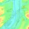
Verrue topographic map

Click on the map to display elevation.

About this map

Name: Verrue topographic map, elevation, terrain.

Location: Verrue, Châtellerault, Vienne, Nouvelle-Aquitaine, Metropolitan France, 86420, France (46.83421 0.13294 46.90039 0.23060)

Average elevation: 93 m

Minimum elevation: 68 m

Maximum elevation: 148 m

Other topographic maps

Click on a map to view its topography, its elevation and its terrain.

Logerie

France > Nouvelle-Aquitaine > Vienne > Bonneuil-Matours

Average elevation: 117 m

La Chasseigne

France > Nouvelle-Aquitaine > Vienne > Thollet

Average elevation: 161 m

Montin

France > Nouvelle-Aquitaine > Vienne > Vicq-sur-Gartempe

Average elevation: 99 m

Les Bordes

France > Nouvelle-Aquitaine > Vienne > Gouex

Average elevation: 108 m

Verrières

France > Nouvelle-Aquitaine > Vienne > Champniers

Average elevation: 137 m

Gear up for your next adventure:

🧼Travel Hand Sanitizer - Keep hands clean when water is scarce
🧼Biodegradable Camp Soap - Environmentally friendly cleaning for gear and body
🦯Trekking Poles - Reduced impact on joints for steep topographic climbs
🥾Trail Hiking Shoes - Durable shoes designed for rugged trails
🥾All-Terrain Hiking Boots - Versatile boots for varied hiking conditions

As an Amazon Associate, this site earns from qualifying purchases at no extra cost to you.