Geolocate

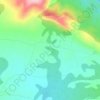
Bicorp topographic map

Click on the map to display elevation.

About this map

Name: Bicorp topographic map, elevation, terrain.

Location: Bicorp, La Canal de Navarrés, Valencia, Valencian Community, 46825, Spain (39.02504 -0.92026 39.17095 -0.76074)

Average elevation: 467 m

Minimum elevation: 140 m

Maximum elevation: 936 m

Other topographic maps

Click on a map to view its topography, its elevation and its terrain.
Valencia

Spain > Valencian Community > Valencia > Valencia

Average elevation: 44 m

Alcossebre

Spain > Valencian Community

Average elevation: 40 m

Moraira

Spain > Valencian Community

Average elevation: 40 m

Oliva

Spain > Valencian Community > Oliva > Oliva

Average elevation: 51 m

Pedralba

Spain > Valencian Community > La Serranía > Pedralba

Average elevation: 177 m

Calp

Spain > Valencian Community > Calp > Calp

Average elevation: 74 m

Santa Bàrbera

Spain > Valencian Community > Sant Mateu

Average elevation: 331 m

Tous

Spain > Valencian Community > Tous > Tous

Average elevation: 119 m

Puntal de Aleto

Spain > Valencian Community > Chelva

Average elevation: 922 m

Gear up for your next adventure:

🧥Waterproof Jacket - Lightweight rain jackets for hiking and outdoor activities
🥾Waterproof Hiking Boots - Boots keeping your feet dry in wet conditions
🛁Quick-Dry Microfiber Towel - Space-saving towel that dries rapidly on the move
👟Sport Hiking Sandals - Breathable footwear for water crossings and camp rest
💧Filtered Water Bottle - Safe drinking water on the go

As an Amazon Associate, this site earns from qualifying purchases at no extra cost to you.