Geolocate

Oliva topographic map

Click on the map to display elevation.

About this map

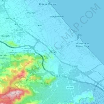
Name: Oliva topographic map, elevation, terrain.

Location: Oliva, la Safor, Valencia, Valencian Community, 46780, Spain (38.88024 -0.16090 38.96024 -0.08090)

Average elevation: 51 m

Minimum elevation: -3 m

Maximum elevation: 459 m

Gear up for your next adventure:

🥾Light Trekking Boots - Supportive boots for multi-day treks
🎒Hiking Backpack - Lightweight and ergonomic backpacks for day hikes or multi-day treks
🧰Emergency Multi-Tool - Compact multi-tool for outdoor survival
🧥Insulated Jacket - Keep warm in cold outdoor conditions
🧥Thermal Layer - Insulating layer for cold outdoor conditions

As an Amazon Associate, this site earns from qualifying purchases at no extra cost to you.