
中牧山丹马场 topographic map
Interactive map
Click on the map to display elevation.
About this map
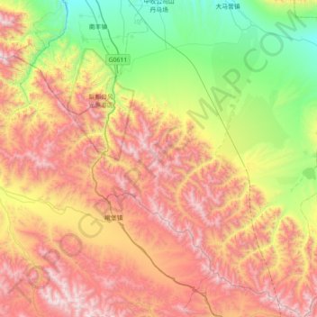
Name: 中牧山丹马场 topographic map, elevation, terrain.
Location: 中牧山丹马场, 山丹县, 张掖市, 甘肃省, 734100, 中国 (37.79113 100.88566 38.34955 101.49843)
Average elevation: 3,338 m
Minimum elevation: 2,458 m
Maximum elevation: 4,492 m
Other topographic maps
Click on a map to view its topography, its elevation and its terrain.