Geolocate

Wistaston topographic map

Click on the map to display elevation.

About this map

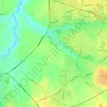
Name: Wistaston topographic map, elevation, terrain.

Location: Wistaston, Cheshire East, England, United Kingdom (53.07154 -2.50946 53.10015 -2.44965)

Average elevation: 46 m

Minimum elevation: 29 m

Maximum elevation: 63 m

Gear up for your next adventure:

🧦Merino Wool Socks - Moisture-wicking comfort for long-distance hiking
🧴Waterproofing Spray - Restore the DWR coating on jackets and tents
🦟Insect Repellent - Keep mosquitoes and black flies away in wooded areas
Camping Coffee Maker - Brew fresh coffee anywhere on the topographic map
🔭Outdoor Binoculars - Lightweight binoculars for birdwatching and hiking

As an Amazon Associate, this site earns from qualifying purchases at no extra cost to you.