Geolocate

Littlebury topographic map

Click on the map to display elevation.

About this map

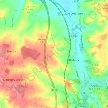
Name: Littlebury topographic map, elevation, terrain.

Location: Littlebury, Uttlesford, Essex, England, United Kingdom (52.01261 0.14939 52.05973 0.22063)

Average elevation: 78 m

Minimum elevation: 36 m

Maximum elevation: 127 m

Gear up for your next adventure:

🧢Outdoor Visor - Breathable visor for sunny hikes
🦶Hiking Shoe Insoles - Added support for high arches and long days on feet
🧴Waterproofing Spray - Restore the DWR coating on jackets and tents
🥾Trail Hiking Socks - Comfortable socks to prevent blisters and fatigue
🧭GPS Handheld Device - Reliable GPS navigation for outdoor adventures

As an Amazon Associate, this site earns from qualifying purchases at no extra cost to you.