Geolocate

Cousinière topographic map

Click on the map to display elevation.

About this map
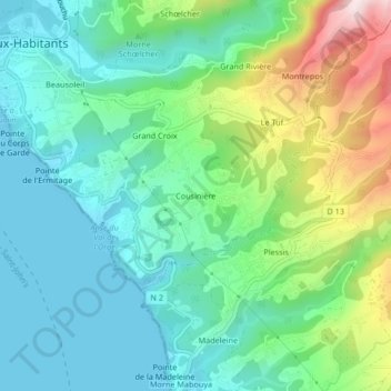
Name: Cousinière topographic map, elevation, terrain.

Location: Cousinière, Vieux-Habitants, Basse-Terre, Guadeloupe, 97119, France (16.02368 -61.76534 16.06368 -61.72534)

Average elevation: 141 m

Minimum elevation: 0 m

Maximum elevation: 515 m

Other topographic maps

Click on a map to view its topography, its elevation and its terrain.

Plage de Rocroy

France > Guadeloupe > Vieux-Habitants

Average elevation: 34 m

Gear up for your next adventure:

🏃Hydration Running Vest - Carry water and maps close to your body for speed
🧳Compression Sacks - Maximize space in your backpack by shrinking gear
🥾Trekking Poles - Adjustable trekking poles to reduce knee stress and improve stability
🧢Beanie Hat - Keep your head warm in cold weather
🧦Hiking Liner Socks - Thin base layer to prevent friction and blisters

As an Amazon Associate, this site earns from qualifying purchases at no extra cost to you.